| |
Navigational Summary
|
|
|
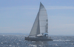
Navigating down the west coast is pretty simple. Keep the shore to
port and the ocean to starboard. So why sweat all the
navigational equipment? Check the correct answer
below. |
|
| |
|
1. Because it fun to play with cool
gadgets?
2. Because the coast guard requires them?
3, Because sooner or later one has to come back
to land? |
|
| |
|
|
|
| |
If you chose 3, you are
right. But number 1 is not totally wrong.
To keep from finding the hard
stuff (land) by surprise Mustang Sally uses a variety of means to keep
the boat on course and the current position well defined. Below a
list of the gear and method:
|
|
| |
|
Hourly "system checks".
About once an hour we go over all the key operating and position
information and confirm all is OK or correct any deficiencies. This is an Excel
spreadsheet that we update each hour. You can download the
template sheet here. |
|
| |
|
|
|
| |
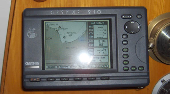
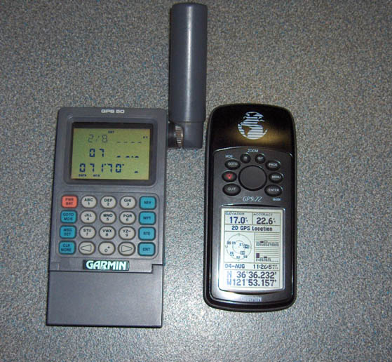
|
Latitude and Longitude tracking via our
GARMIN 210 GPS
MAP. It is only accurate to plus or minus 50 feet - but that is
good enough for the girls I sail with! Sally's two back units are
a Garmin GPS 72 and a GPS 50. Should be good enough?
NO! Just north of Santa Cruz, California the 210 failed.
So I fired up the backup GPS 72. It couldn't get a position either.
Both were reporting poor signals. "Uh oh" I thought ... "Was
Uncle Sam blasting away at some new terrorist haven?"
Rubbing my hands together in worry then start with dead reckoning.
Barely got going with the DR routine and both GPS's jumped back to
life, maybe 45 minutes later. |
|
| |
|
|
|
| |
|
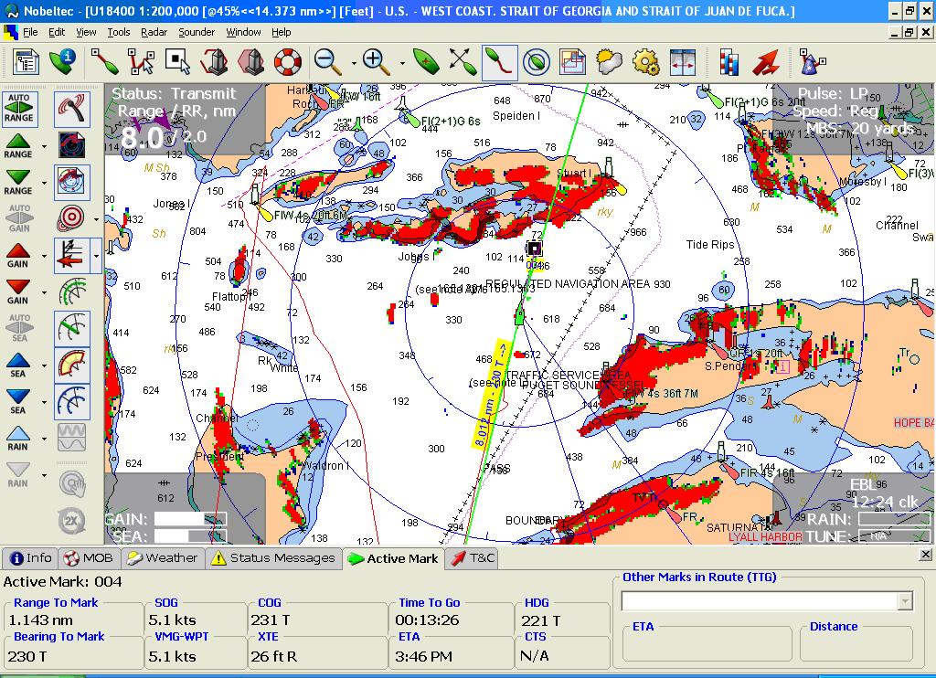
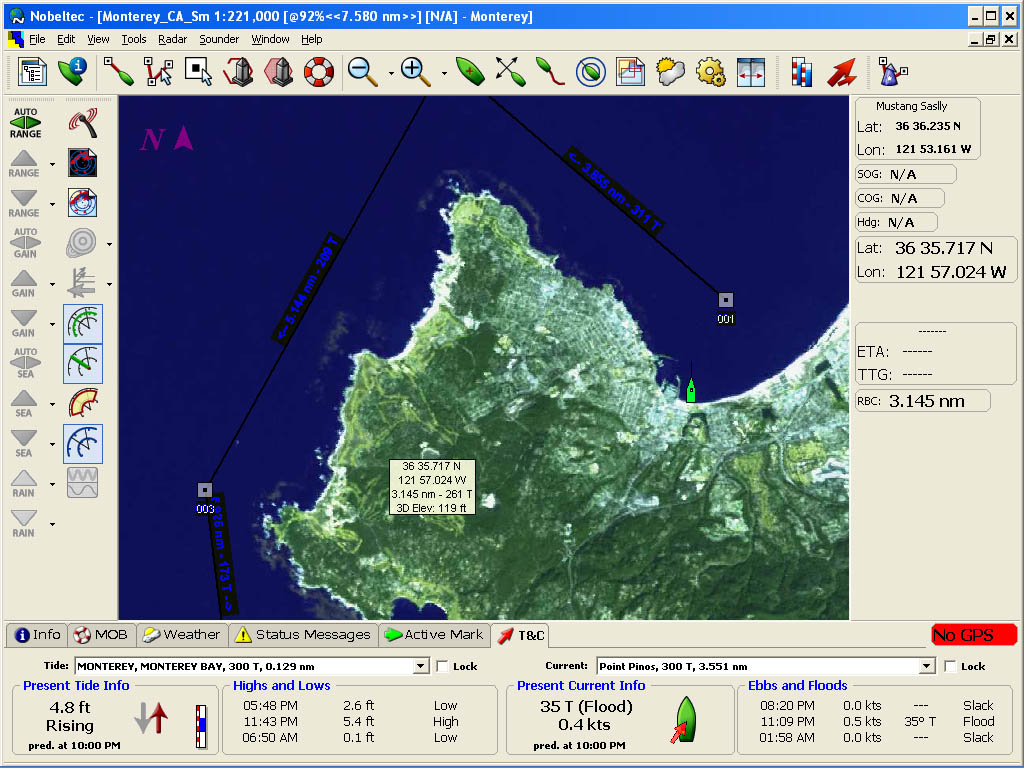
Nobeltec Visual Navigator
provides electronic charting. The system and vector charts
are top of the line. The charts are expensive and the system has
some gottcha's:
- Nobeltec support sucks, often takes a week to get in touch with an
inexperienced non-boating nerd, who's best suggestion is to re-boot and try again.
Pretty pathetic.
- Under XP, if the software crashes and you modify your route
before the software crash, the program will automatically restart,
using the un-modified route. Very serious if you use the
software in conjunction with your autopilot, as you may not even
notice that the software has crashed and restarted. Is this
what got the BC Ferry?
- The data base corrupts regularly. That throws the program into a
recovery loop that can only be avoided by using task manager to kill
the software and then deleting the data base. When you delete
the 'database' the program looses all routes, waypoints, etc.
Note what Nobeltec calls a database is in reality a simple text
file.
Nobeltec can use any raster charts.
The company provides some helpful navigational photos
and the coast
guard charts are also interesting to provide another view.
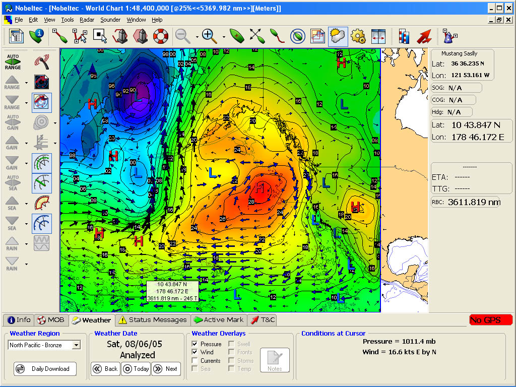
The weather overlays are
also useful for large scale planning. Where available I primarily
use local weather forecasts for coastal navigation.
Prior to each leg, I use the Nobeltec software to plot the course
then analyze in detail to insure we are well clear of all dangers. As we
travel, I monitor position and course continually.
While underway, most often we run with the
Comnav autopilot steering down the
plotted course. The Connav unit requires manual adjustments to get
the best steering response, power usage, activity combination in
different wind/sea conditions. In close quarters hand steering is
required.
We can steer the boat using the Nobeltec software and the autopilot, but
doing so is rather clumsy. Most often we use the autopilot
controls for dodging debris or to alter course temporarily.
When sailing, the autopilot steers a better course for the wind when
it is steering to a magnetic heading. |
|
| |
|
|
|
| |
|
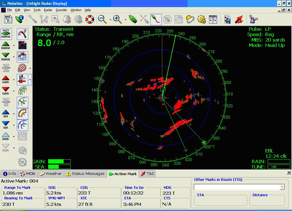
Nobeltec Radar provides
electronic eyes that see when I can't. The radar overlays on
the charts are very helpful for learning radar. Also working with the radar when
visibility is good helps to learn what it can and can't do. When
it works it is great!
Nobeltec's radar is supplied by Sitex, who are based in Florida.
Sitex get the radar units from the Japanese Manufacturer - Koden.
A little further down the food chain than I like.Radar support from Nobeltec is
pathetic. Sitex has better support, but Sitex had trouble
executing a repair for me. Took about 6 weeks to do a repair from
Mexico. For 2 of those weeks, the unit sat on the Sitex shipping
dock. As it was a warrantee repair, Sitex said they would
pay 1/2 the shipping. But when the shipping department found out
the unit was bound for Mexico - it was no way Jose!
Everything stopped until I chased them down and found they would not
honor the return shipping. |
|
| |
|
|
|
| |
|
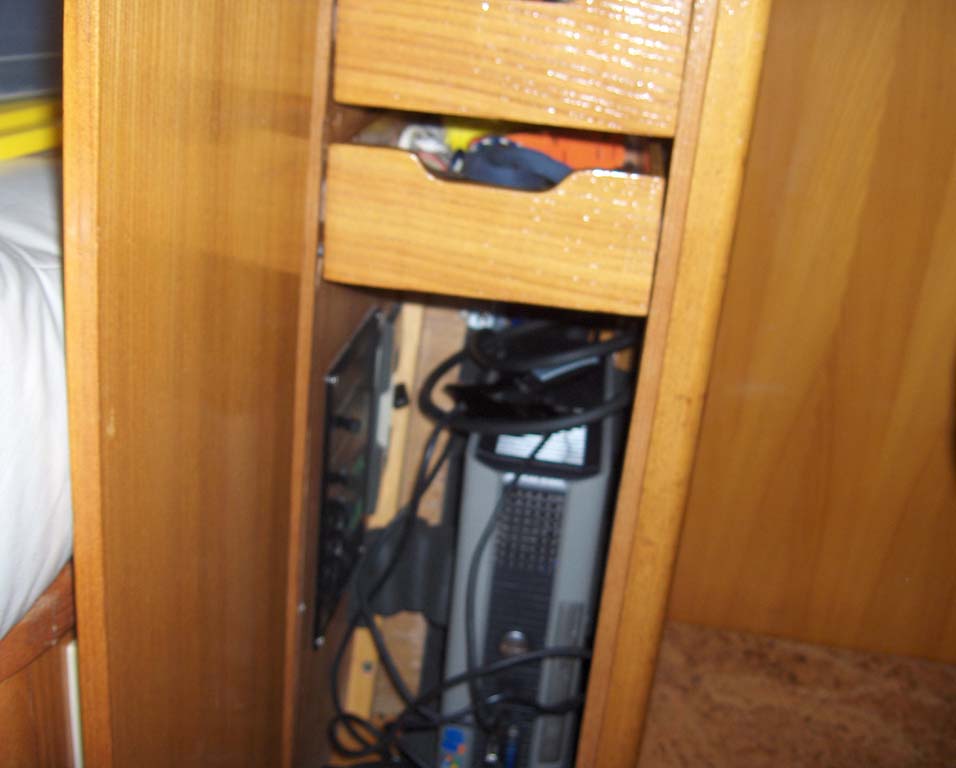
A
Dell Optiplex Computer hides
in a compartment in the navigation station and provides the main
computing power for Nobletec and the boat. I chose this unit for
its reliability, low cost, small size and 12 volt power feed requirement.
Downside is the 6.5 amp power requirement. |
|
| |
|
|
|
| |
|
A 17 inch VarTech monitor
provides visual output from the computer. This unit is 12 volt,
has a great industrial strength display that can be read in all
conditions. It draws about 2.5 amps depending on brightness
settings. |
|
| |
|
|
|
| |
|
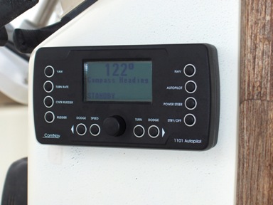
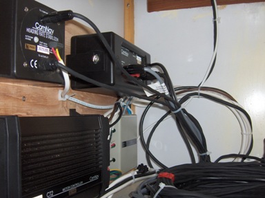
A
Comnav 1101
Autopilot
operates independently or via direction from the Nobeltec software.
95% of the time, this unit steers the boat in "navigation" mode.
In this mode the autopilot steers the defined track that we configure
using the Nobeltec charting software. |
|
| |
|
|
|
| |
|
A Mitsubishi Notebook computer
is carried as a backup for the Dell computer.
Speaking of backups - I have a replacement disk that I keep loaded with
the current software and data. I can change out the disk in about
5 minutes. I also have two additional backup disks on which I keep
redundant copies of the software and data. I update the data backups
every week and the software once a month. |
|
| |
|
|
|
| |
|
A Raytheon depth sounder is
essential for confirming positions. |
|
| |
|
|
|
| |
|
A pair of Steiner Binoculars
with a built in compass is great for taking hand bearing. |
|
| |
|
|
|
| |
|
A Platismo binnacle compass is
used occasionally for steering on the ocean. |
|
| |
|
|
|
| |
|
A backup Raytheon Wheel Pilot
is also installed and configured to work either independently or under
control of the Nobeltec software. |
|
| |
|
|
|
| |
|
Mustang Sally also carries a plastic
sextant. If all the electronics blows out, I should
be able to determine a position accurate to 5 miles or so. |
|
| |
|
|
|
| |
|
|
|